|
||
|
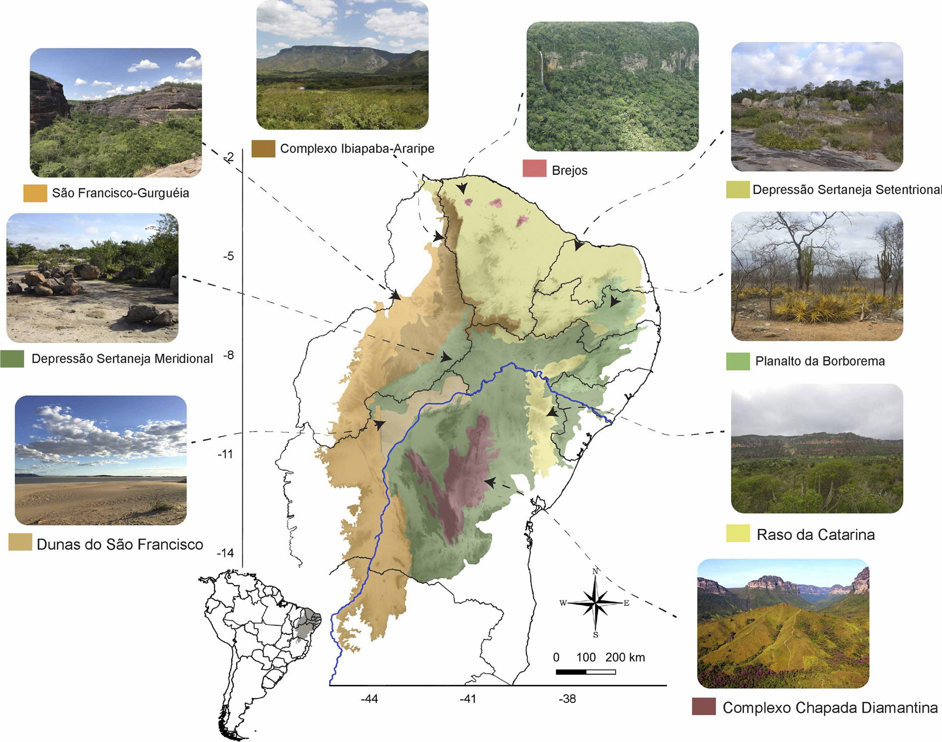
Caatinga map showing the geographic location and coverage of the study area, northeast of Brazil and phytophysiognomies of the Caatinga ecoregions (following Silva et al. 2017). São Francisco River (blue line). Photo credits: Brejo de Altitude do PARNA Ubajara, Ceará state, photo by Daniel Loebmann; Chapada Diamantina, municipality of Palmeiras, Bahia state, photo by Daniela Coelho; Depressão Sertaneja Setentrional, municipality of Cabaceiras, Paraíba state, photo by Thaís Guedes; Dunas do Rio São Francisco, Bahia State, photo by Leonardo Ribeiro; São Francisco-Gurguéia, Piauí State, photo by Daniel Mesquita; Ibiapaba – Araripe, municipality of Ubajara, Ceará State, photo by Daniel Loebmann; Planalto da Borborema, municipality of Pocinhos, Paraíba State, photo by Edilson Guedes; Raso da Catarina, photo by Tiago Azevedo. |